The bodies of the three men who were lost following the massive landslide in western Colorado on May 25 may never be recovered, but not for a lack of trying. Unmanned Aerial Vehicle (UAV), or drones, played a key role in an exhaustive search that failed to yield signs of the men.
“I think a certain amount of time having elapsed to this point is a strong suggestion as to the potential to actually recover those bodies and I think it speaks to the size of the mudslide itself,” says Ben Miller, Mesa County’s unmanned aircraft program manager.
On Sunday, hundreds gathered in a school in the small town of Collbran to remember the men who went missing after the landslide occurred -- 51-year-old Clarence "Clancy" Allen Nichols, his 24-year-old son, Daniel Allen Nichols, and 46-year-old Wesley "Wes" Melvin Hawkins.
Miller says drones were used to help understand the extent of the debris field. He says he’s has never seen such extensive damage from a natural disaster.
“I would even suggest that the state of Colorado may have not seen something of this magnitude in known history,” Miller says.
The slide is nearly three miles long and about a half mile wide at its widest point, he says.
Rescuers initially trod into the slide area but the Mesa County Sheriff’s Office concluded that those efforts on the ground were too risky to continue because the debris field could shift. Drones became a useful tool, flying in several dangerous areas including the last known location of the missing men.
“We wanted to make sure we weren’t putting our staff and volunteers into harm’s way,” Miller says.
Drones can be deployed at a much lower cost than helicopters, helping save money.
“[Using] a Blackhawk can be anywhere from $10,000 to $15,000 an hour to the taxpayer,” Miller says. “They get pretty expensive pretty fast. You know, jet fuel is not cheap, whereas our small unmanned aircraft systems that we were using for the search and rescue efforts cost us just a mere $25 an hour.”
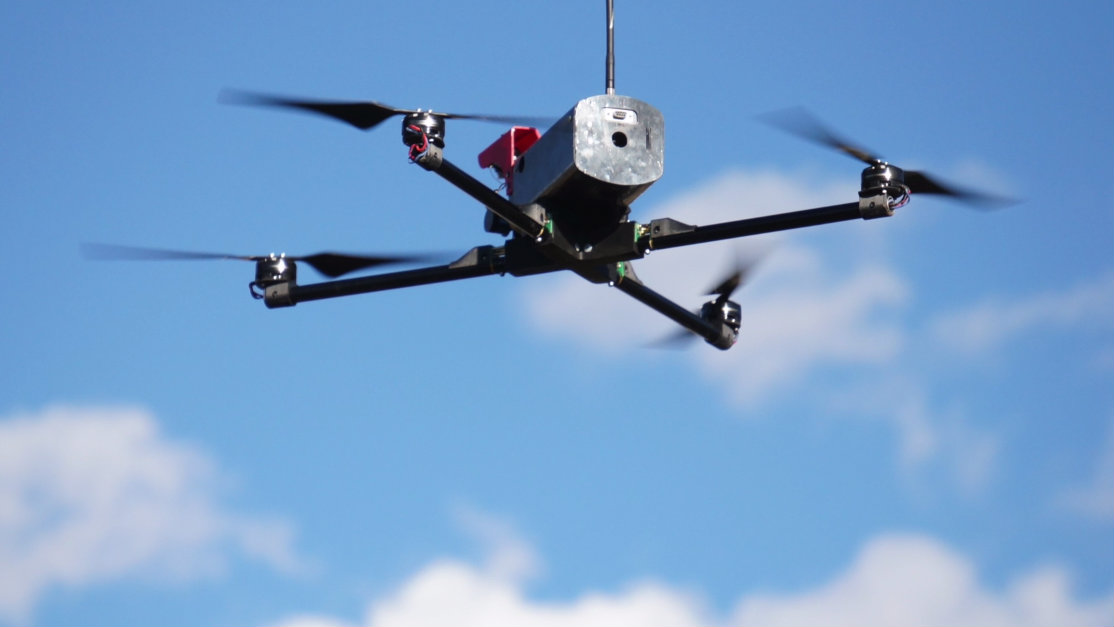
The small drone fleet that Miller oversees should not be confused with large military drones, such as Predators, which are used in U.S. intelligence operations. Rather, Mesa County’s drones are more like large radio-controlled model aircraft. They are flow in line of sight from vantage points, such as hills.
An advantage of the drones is the quality of the images they are able to capture. That may sound high-tech, but reason is simple: Mesa County’s drones can fly much closer to the ground than manned aircraft, getting cameras closer to their subjects. Miller says the drones use an off-the-shelf camera that shoots about 24 megapixels.
“So about 100 feet off the ground with a camera of that capability, the images have a significant resolution to them,” Miller says. “That allows us to look through each image that we collect from a search perspective and look for things that would cue us to a known location – a piece of a vehicle or something like that.”


