Original post 11:25 a.m. | Updated 5:00 p.m.
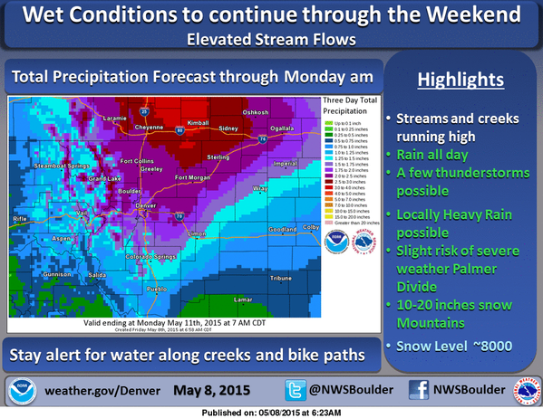
Looks like it's going to be a soggy Mother's Day in a lot of places. A long stretch of stormy weather continues over Colorado, with more rain for the Front Range, and snow forecast for this weekend in the mountains. It will be next week before the storm that’s brought snow, hail, and a lot of rain to Colorado starts to clear up, the weather service says.
CDOT says that with flood watches and advisories already in place, its crews at are stepping up patrols in areas prone to flooding, and roadways that flooded in September 2013 floods. Travelers public to check on cotrip.org for updated conditions.
A winter storm watch remains in effect for Colorado’s high country and parts of nearby states. The National Weather Service says up to 2 feet of snow is possible in parts of northern Colorado and Wyoming. Areas of western South Dakota could see a foot of new snow. The wintry weather is expected to begin this evening and get heavier through the weekend.
Around the West in general, the winter snowpack is mostly gone. Monitors with the US Department of Agriculture say one of the exceptions is northern Colorado, where the mountains do have some snowpack left. Meantime, the West’s water supply still looks sparse this year. Stream flows into Lake Powell in Utah are predicted to be about one third of normal.


