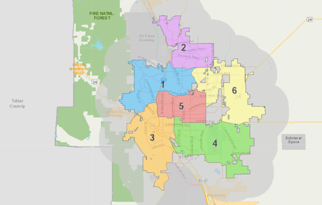
Colorado Springs has officially redrawn its district map for city council seats.
The city clerk released the final version on Nov. 22, after several months of public meetings and discussions.
The new map is identical to the preliminary map released in October. City Clerk Sarah Johnson said that version was selected from the three options presented earlier this year after considering public comments and the input of the 9-member district process advisory committee.
City Charter requires the clerk to redraw districts every four years to account for population changes.
The population of Colorado Springs has increased substantially since 2020 to just over a half million people in the metro area, according to the city.
The goal of redistricting is to have a roughly equal balance of citizens throughout the six districts of Colorado Springs. As a result, 25 precincts were moved to other districts this year. The new maps give each district between 80,000 and 85,000 people.
The shuffling of precincts also accounted for future growth along the northern and eastern areas of Colorado Springs, according to city officials.
The new maps will be used during the upcoming municipal elections for all six city council seats on April 1, 2025.
All of the maps can be viewed and downloaded on the city’s website.


